Snow avalanches kill, on average, 22 people per year in the Swiss Alps alone. This makes them the most deadly natural hazard, responsible for more than one third of all natural hazard fatalities. The main source of information on avalanche hazard in Switzerland for authorities, safety personnel of ski resorts and traffic lines, as well as the public, is the avalanche bulletin of the WSL Institute for Snow and Avalanche Research SLF. The avalanche bulletin is compiled by experienced avalanche forecasters based on data gathered from automated weather stations and observers in the field. However, spatially continuous, near real-time information on avalanche activity, which would be key information for the bulletin, is not available today due to the remoteness of many alpine regions. Information provided by the observer network is highly incomplete. Optical satellite imagery with high spatial resolution on the other hand, is inflexible because it only covers selected areas on request, is very costly, often obstructed by high cloud cover and is generally limited in temporal resolution to days between repeat observations.
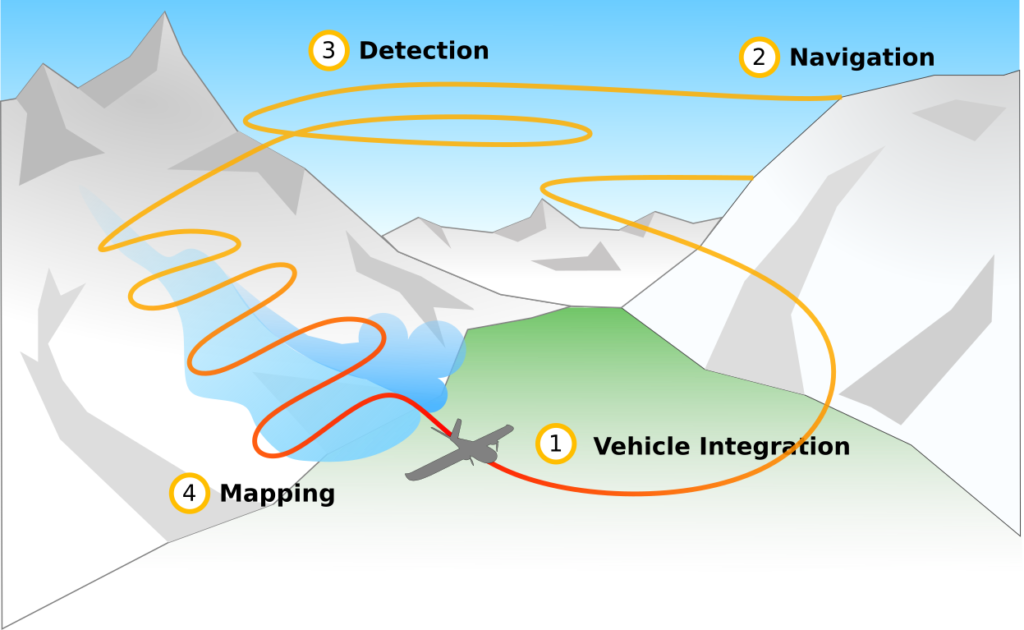
The AVALMAPPER project aims to fill this gap by creating an aerial system for collecting
high-resolution avalanche occurrence data over affected regions in the Swiss Alps. This is a collaboration between the Autonomous Systems Lab (ASL) at ETHZurich and SLF. The partners aim to develop and test a long-endurance (multi-hour) autonomous aircraft, that will use on-line adaptive planning techniques and machine learning to identify and map avalanches using near-infrared imagery. The project will draw on the expertise of ASL in developing autonomous systems for operating in complex, real-world conditions. ASL has demonstrated experience operating aircraft in challenging environments (including deployment of a solar-powered aircraft to monitor glaciers in Greenland in 2017, and a multi-rotor drop-and-recovery payload mission on the Gorner glacier in 2019). SLF provides unmatched real-world experience and domain knowledge in detecting, mapping, and modelling snow avalanches.
The development and optimisation of an avalanche activity mapping system based on a UAS that is able to fly intelligently in high-alpine terrain and cover large areas would be a major breakthrough in information acquisition in poorly accessible mountain regions. This data could be used not only for avalanche warning but also for search and rescue (including end users REGA and SAC rescue), landslide monitoring, and hydrological applications such as hydropower or floodwarnings. This will substantially contribute tomaking mountain regions safer for inhabitants and visitors.
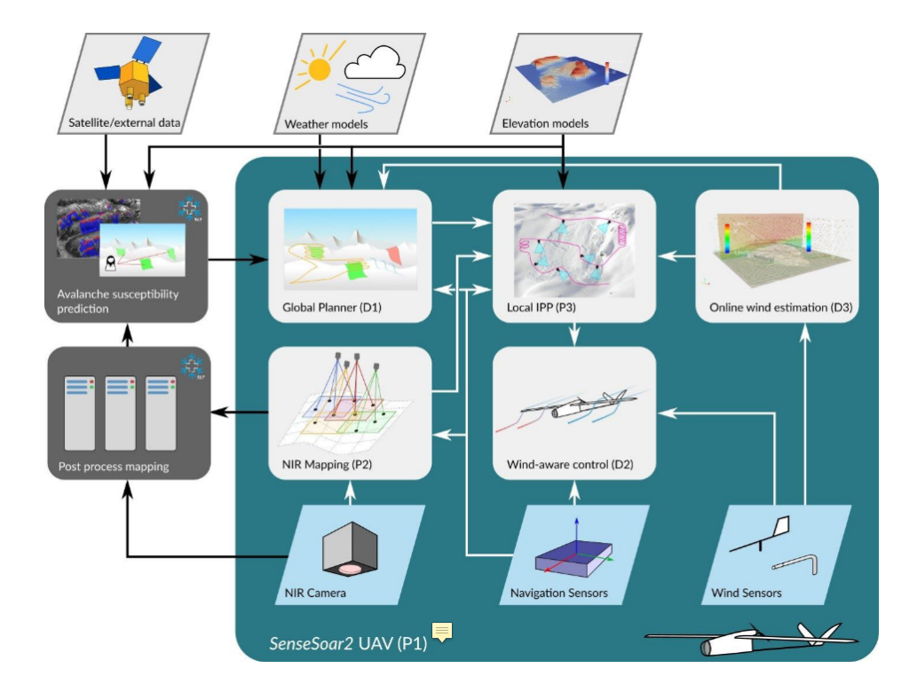
A complete system may look as the following diagram