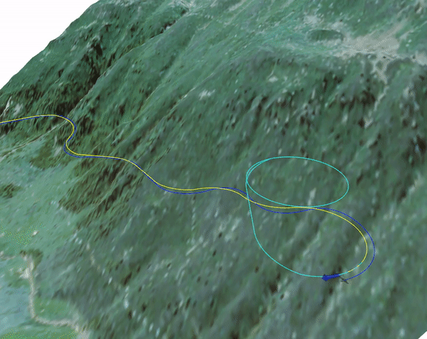
Navigating in steep terrain with a fixed wing vehicle is challenging due to the constrained dynamics of the vehicle. Fixed wing vehicles are limited with minimum turning radius and maximum climb rates. This is a problem especially in the Swiss Alps, where terrain can be steeper than the vehicle can climb or turn. This can result in a Inevitable Collision State(ICS) where the vehicle cannot avoid a collision with the feasible input.
The problem gets even more challenging with the current regulations require staying under certain altitudes from the terrain vertically, constraining the space available for the vehicle to fly.
Therefore in order to be able to operate the vehicle safely, it is important to account for the dynamics of the vehicle and plan safe paths to navigate through the terrain. In the Avalmapper project, we would like to address these challenges of operating long endurance vehicles in complex challenging terrain.