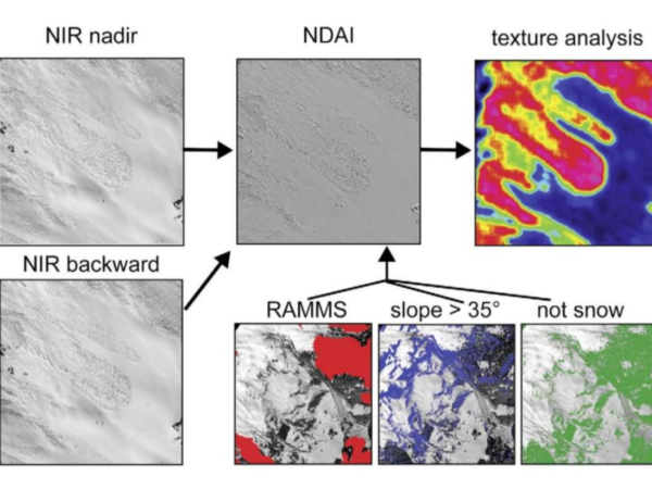
In the AVALMAPPER project, we aim to use NIR imagery for mapping alpine areas. Previous work hasshown that the NIR spectrum is the best choice […]
Active Terrain Mapping
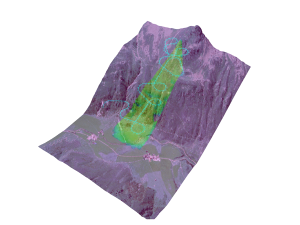
Map reconstruction from camera imaging systems generally relies on features to build a 3Drepresentation of points in the imaged domain. There are multiple factors that […]